
|
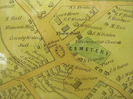
Maps Maps provide all sorts of information about locations. Changes over the years can be seen by comparing seral years of maps from the same location. Maps also provide us with much more than geographical perspectives. Some maps are considered pieces of art, others provide us with all sorts of information like names of residents, and still others show military battles.Meet the Map Analysis Guide from the National Archives and Thinking About Maps from the Library of Congress will help student focus on the features they observe on maps. Photographs were taken of the 1852, 1883, and 1906 Concord and Middlesex Country maps from the Geography and Map Division of the Library of Congress. Click on the image to view a larger version and complete the activity.
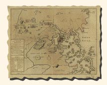
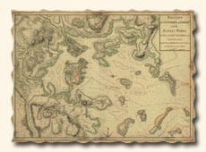
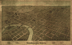
The Library of Congress has a rich collection of historical maps of the Revolutionary War era. Many were created by British cartographers. A nice feature at the Library of Congress Website is the ability to zoom in on specific areas of the map. Examine the maps below. What are some of the interesting features of these early maps? How do they compare to the maps you see today?
|
Geography and Map Division Learn about powder horn maps from Patricia van Ee, one of the curators in the Geography and Map Division at The Libary of Congress. She also describes a creative use of maps by a former merchant, and a technology that allows you to zoom in znd out of maps. Powder Horn Map of New York- map inscribed on a powder horn Map Ladies- ladies made from maps Mr. Sid- technology tool to use with maps |
|||||||||||||||||||||||||||||||||||||||||
|
|||||||||||||||||||||||||||||||||||||||||||


© 1996 - 2011 Linda C. Joseph
All Rights Reserved
All CyberBee Graphics are Trademarked
Graphics by
Darlene Vanasco/Creative Director
Erika Taguchi/Designer & Illustrator
Hosting Provided by Iwaynet