| Pioneers/Students |
Scouts/Teachers |
General Store/Resources |
| |
Main |
Travel & Fates |
Travel and Fates: Set #1
Travel & Fate Card 1
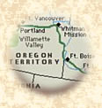
Fort Independence to Fort Kearny
Independence Courthouse Square
Mile 0.0
May 1
Dawn paints the day with a clear, almost harsh, light. As you make your final preparations for what will be the greatest adventure of your life, you look around at scenes you'll leave behind: white picket fences, clothes hanging on a backyard line, children laughing on their way to school... You start to feel a tinge of regret. Should you really go through with this? No time for second-guessing! Because now you have another decision to make.
Over at Courthouse Square, they're selling livestock. Oxen for $25 per yoke, mules & horses from $30-40 per head. Will this be your last chance to buy? What will you do?
(After you reach your decision, read the fate.)
Fate: If you decided to spend
this money for extra oxen, subtract this amount from the general funds you've
budgeted for the trip. Don't forget to add the additional animals to your list
too. These animals will be useful later in your journey. If you decided not
to buy you may have saved money now but will be in need of fresh animals somewhere
along the trail.
Travel & Fate Card 2
Independence Spring
Independence, Missouri
Mile 0.0
May 1
Your pack horses are rubbed down and ready and your oxen team in place. Your belongings are packed. Your food rations carefully secured. Many of the parties in your wagon train are already lined up and ready to move out. But you still have to get one more vital item: your drinking water!
Will you top off your kegs from the drinking water available here at Independence Camp? Or wait until you get to the next stop this evening?
(After you reach your decision, read the fate.)
Fate: If you decided to top off your kegs this is your fate: Moments after topping off your water kegs you notice a mud splashed sign: "Contaminated Water! Cholera!" Now you must dump your supply and travel until evening before refilling your keg. Will any families share their supply?
(Teacher's note: Provide students with a research opportunity on Cholera. This was a common contaminate in the water supply along the trail)
Travel & Fate Card 3
Crossing of Blue River
(Red Bridge) (South of Metropolitan, Kansas City)
Mile 15.2
May 2
The sky is getting blacker by the minute. And you can see the streaks of rain headed right for your wagon train. But getting soaked to the bone in a downpour is the least of your worries, because today you must cross your first major river: The Blue River.
You'll first have to unload almost everything from your schooner and place it in ferry boats. Then, you'll take the wheels off your rig (so it can slide easily up and down the banks. Your ferry and your rig must be tied tight to the rope that crosses the river. This is to keep you all from being carried downstream. This process is as slow as molasses and it could take days for your entire party to cross. Are you ready to try it? (Do you really have a choice?)
(After you reach your decision, read the fate.)
Fate: Yessiree!, It took you all day and most of the next for all the wagons to cross because you had to swim your animals across too! You all make it safely, but you all got mighty wet. Well you ought to know that they eventually DO build a toll bridge here.
Travel & Fate Card 4
Trail Junction of the Santa Fe and Oregon Trails
(1.8 miles west of Gardner, Kansas)
Mile 39.4
May 3
Country with her ever-nurturing rains. Others dream of the dry, golden hills of the Southwest, where rain is but a memory from the Eastern coastline. But now the moment of truth is here. You've reached the fork, the final decision.
The sign reads "SANTA FE ROUTE" this way, "ROAD TO OREGON" that way. Which way will it be?
(After you reach your decision, read the fate.)
Fate: (Oregon Trail)Those who decided continue on to Oregon, but stop and wave good-by to the weeping group of friends and kin, must spend the night here and catch-up with the others early in the morning. (Santa Fe Route)Those who made a last minute change in their travel plans and decided to head south get caught in a wild thunderstorm. The trail turns to mud and the deep wagon ruts cut in the trail here now fast moving streams. This not only makes travel near impossible but discourages everyone. You turn back immediately and join everyone on the Oregon Trail. Yeeehaaa!
Travel & Fate Card 5
Observation Bluff
(A ridge west of Captain Creek, Kansas)
Mile 47
May 4
You've heard the stories. You've read about it in the Newspapers and emigrant guide books. But now you're here. This is the spot where a climb to the top of the bluffs will reveal a view of the trail that winds for weeks into the distant plains. They call it a "close look at infinity."
Do you climb the bluffs to see what lies ahead? Or keep moving to make precious miles on the trail and keep the future a surprise?
(After you reach your decision, read the fate.)
Fate: Those families who had family members climb the bluff lose 4 hours of travel time along the trail and will arrive in camp late, tired, and hungry. But it was worth the delay!
Travel & Fate Card 6
Crossing of Wakarusa River (Blue Jacket)
(5 miles southeast of Lawrence, Kansas)
Mile 54
May 5-7
You thought Blue River was meaner'n a chained dog to cross? Then you don't know beans from a buckshot! Because you've just reached the most difficult river crossing on the Oregon Trail. "Wakarusa" means thigh-deep. But the Wakarusa River rarely is. Within hours it can flow from a sluggish river within steep banks to a dangerous flood overflowing to the nearby marshes. You can see the murky, brown pools that have the slimy glisten of water snakes and leeches.
You must spend several days in the painstaking process of moving supplies and children, lowering your wagons by means of ropes, and fording the racing river. How will you cross this river? By the way, how many oxen do you have?
(After you reach your decision, read the fate.)
Fate: Those families that had less than 10 oxen to pull their wagons across had to pay a local Shawnee Indian named "Fish" $5 to pull their wagons out of the mud.
Travel & Fate Card 7
Independence Crossing
Marshall County, Kansas
Mile 165
May 14
As is often the case, the speed with which you can make your journey is out of your hands. It is truly in the hands of the fates. Though you are now almost half way to Fort Kearny, a sudden summer prairie rain storm has brought your train to a grinding halt. High winds (and occasional funnel cloud sightings) have forced you to take refuge in or under your rigs. And the broiling waters have made this crossing impossible.
(Your fate is out of your hands. Read it anyway.)
Fate: You and the contents of your wagon are soaked to the bone. You and the members of your family end up spending a miserable cold and wet night near the river bank and wait until the storm passes and the water level drops. Are you sure you want to take this trip? ******************************************************
Travel & Fate Card 8
Fremont Springs
(4 miles south of Diller, Nebraska)
Mile 194
May 16
Cold coffee and a bite of stale bread. That's what you usually have when you stop to noon. You kill at least an hour when you stop, but the renewed strength it gives your animals well makes up for the loss of time. It's also good for everyone's tempers too.
Despite the high winds, a few of you climb the sandstone outcrop above the springs. Here you find two very famous names engraved in the rock: John C. Fremont and Kit Carson.
(Your fate is out of your hands. Read it anyway.)
Fate: Ah! the taste of fresh spring water! A restful nap! Time to hit the dusty trail. You will need all the rest you can muster for the journey that lies ahead.
(Teacher's note: Discuss the trip of these famous mountain men and explorers. Their names as well as others are engraved there. This spot is mentioned frequently in overland journals)
Travel & Fate Card 9
The Narrows
(1.5 miles northwest of Oak, Nebraska)
Mile 252
May 20
Progress has slowed to a crawl in this bottle neck between the Little Blue River and the bluff on its east bank. There is barely enough room for a single wagon to pass. Even the cattle have to go through in single file.
One of your party has been bit on the ankle by a rattlesnake. Is it deadly? You've tried every know remedy to try and heal the wound in a frantic attempt to keep his leg. Should it be sawed off with a common handsaw to be saved? What is your remedy?.
Time to research the answer!!! (Kids and that's your homework tonight!!)
(After your research is complete read on to find out your fate.)
Fate: For those family members who have gone to the trouble to find a remedy to rattlesnake bites your leg is saved. Alas those who did NOT do the research lose the use of their limb. Will you have to limp to Oregon or can you ride in the wagon a few days to recuperate? (At least you don't lose your life!, Sometimes homework can be a life or death situation.)
(Teacher's note: This idea was taken from Catherine Haun's Diary. See L. Schlissel Women's Diary of the Westward Journey.)
Travel & Fate Card 10 *
Fort Kearny "Fort Childs"
(5.5 miles south of Kearny Nebraska)
Mile 319.
May 30
There it is! Finally! The sod and adobe buildings of Fort Kearny. The first sign of civilization you've seen in months! Here you can replenish supplies, make repairs, even send back letters home.
Bacon $1 a pound, 10 pounds flour $2, 15 pounds beans $1.50 and each letter 10 cents.
You certainly have a lot to write about!
(Read on to find out your fate.)
Fate: Spirits are high. Talk of the nostalgia of home has almost disappeared and you're all anticipating the new lives ahead of you. The letter you send home to friends and relatives are positive and filled with adventure and hope. Subtract the total amount of money spent on additional supplies for the journey. You learn that your next supply post is Fort Laramie.
(Teacher's note: This is an opportunity for students to review their travel along the trail and write the summary in the form of a letter home to kin, cousin, or friends. This letter can also be used as an informal student evaluation or assessment tool.)
Travel & Fate Card 11
Midway Station
(4 miles south of Gothenburg, Nebraska)
Mile 383
June 10
Alas you are midway between Fort Kearny and Fort Laramie looking out along the banks of the beautiful Platte River...where wildflowers dance in the wind on the shore and tufted islands dot the river's bubbling path.
Young and old alike take this opportunity to shed weeks of prairie dust in the river's clear cool waters, while others change the oxen, barter for supplies and refill your water kegs. What will you do to rest up here?
Fate: For those of you who've chosen to bathe, your chances for disease will be lessened and you'll feel healthier and more energetic. Those of you who've increased your provisions and tended to your animals will be rewarded in the long run.
Travel & Fate Card 12
Gilman' Station
(8 miles west of Gothenburg, Nebraska)
Mile 401
June 11
Here's someone you haven't seen for a long time: a blacksmith. And what a pleasant surprise! Your oxen and horses' shoes have been worn down for weeks -- adding more and more time to each day's trek. You can also trade your tired oxen here for fresh ones.
Decide here how many animals you want to shod and how many oxen you wish to trade.
(After you reach your decision, read the fate.)
Fate: If you decided to trade, it was not
in your favor. Jud Gilman, the owner trades two for one, that is one well animal
for two tired animals. Subtract the number of animals you lost in this trade
from your supply list. If you decided to shod all your animals your choice is
a good one. Subtract 50 cents from your budget for each animal you had shod.
Your animals will be high stepp'in along the trail in no time.
Travel & Fate Card 13
Cottonwood Springs
(4.4 miles south of Maxwell, Nebraska)
Mile 406
June 13
After days on the dry, desolate plains, it seems like forever and a day since you've felt the cool, caress of a big ole' shade tree. And no trees are better than these cottonwoods here in this pleasantly surprising oasis.
You can "noon" here for your usual hour. Or stay a little longer - taking advantage of the shade and the stream-fresh drinking water - and catch up with the others later.
(After you reach your decision, read the fate.)
Fate (Those that stay)Those who decided to stay and rest have lots of good energy. Children played and adults took a well deserved rest. (Those that rush forward) Those that rushed forward are extra tired and severely sunburned because they travel during the hottest part of the day.
Travel & Fate Card 14
Lower (old) California Crossing
(3.8 miles west of Brule, Nebraska)
Mile 485.
June 23
The South Platte. Shallow.. Doesn't move too fast. And has gentle banks. Easy as pie, right? NOT! This body of moving water is a mile wide. There are no trees or broken branches to put under the wheels. And the river bottom is quicksand! Imagine how fast your wagon wheels will sink to the hubs in that stuff! How are your going to get through this one? Any ideas?
(After you reach your decisions, read the fate.)
Fate: You sink! Almost. You could have lost everything, including your dog named Watch. You didn't know that you couldn't go straight across. Here you learn a lesson about how cross a river. First you traverse the river diagonally down with the current, then halfway across you have to turn back up against the current - sometimes adding another half mile to the traverse. This time you ended up paying a Frenchman to help you out...a tin of sugar and a tin of flour out of your supplies . Needless to say, everyone is very tired and a bit out of sorts.
Travel & Fate Card 15
Windlass Hill
(Garden County near Ash Hollow, Nebraska
Mile 500
June 25
A 25� drop for 300 feet. Brakes won't work. And you don't have skis on your wagon either. What equipment (supply list hint: that you haven't had to use yet) do you need? How are you going to use it? And how much time will you lose?
(After you reach your decisions, read the fate.)
Fate: (NO chains or ropes) If your decision to secure your wagon doesn't include chains and rope, your wagon and all its contents will slip away. You will need to stop and make repairs and pick up all the things that are scattered everywhere! (YES chains or ropes) If you did include chains or ropes in your decision, you and the contents of your wagons make the descent down the deep ravine safely in about three hours. ***Somehow, in all that pushing and pulling and reorganizing, your dog, Watch, disappeared.(Did you know even you had a dog named Watch?)
(Teacher's note: Early pioneers never used a windlass here despite the name. This spot is mentioned in diaries and made an impression on early pioneers. Travelers were mostly on level prairie until they reach this deep ravine.)
Travel & Fate Card 16
Ash Hollow Spring
Garden County, Nebraska
Mile 504.5
June 26
Ahhhhh! The springs here provide the best darn water to be had for many miles. In fact, there's no train, no wagon, nobody that don't stop here! Which is why it's a good place to read or leave messages. You can look for messages from those ahead of you on the trail. Or leave them for friends and family traveling a few days or weeks behind you. Since you are outside the postal boundaries of the United States, if you wish to send letters to your families back East, you need to pin a coin and note begging some east bound trader or straggler returning to take them back to the "states" and mail them there. It's also a good place to leave notices about lost cattle, pets, even children!!! (Remember Watch?)
(After you reach your decisions, read the fate.)
Fate: Leave a message describing your dog, Watch, who disappeared
(in case you were absent) at Windlass Hill. Make sure you describe him perfectly.
(or draw a picture too!) There are a lot of dogs on the Oregon Trail...
Travel & Fate Card 17
Courthouse Rock
(5 miles due south of Bridgeport, Nebraska)
Mile 561
June 30
Since there are no trees anywhere, you've noticed this massive
landmark has been looming off on the horizon like some forgotten castle for
several successive days. And now you've finally reached it. This sandstone landmark
is beautiful to look at. But it doesn't have any trees either... Remember?.
And, you're out of firewood. What will you do?Ever hear of buffalo chips?
(After you reach your decisions, read the fate.)
Fate: Buffalo chips are the drying dropping of (you guessed
it!) buffaloes. Everyone (and that includes you) has to carry a burlap sack
with them on the trail and gather as much of this as they can. When it burns
it smells like dried grass and makes excellent hot fuel for cooking. But it
burns fast. So, gather a lot!!!!
Travel & Fate Card 18
Chimney Rock
(3.5 miles southwest of Bayard, Nebraska)
Mile 575
July 1
Everybody who's passed this massive 300-foot, outcropping writes about it. And most of you write ON it. Which makes Chimney Rock the most popular canvas for emigrant graffiti along the Oregon Trail. Climb up and leave your name for kids in the next century to read. Then check the messages left at the bottom of the rock to see if there's anything interesting.
(Any guesses on what message you will find? Read on!)
Fate: You read a "FOUND" message about a dog whose description
matches Watch's. (Hey, don't you remember Watch?) It seems this dog has been
found by U.S. Calvary Soldiers on their way to Fort Laramie. You try not to
get your hopes up. But how far is Fort Laramie, anyway?
Travel & Fate Card 19
Scotts Bluff
(2 miles northwest of Gering, Nebraska)
Mile 596
July 4
You've had a good day of travel. And everyone enjoyed hot buffalo and root stew around the campfire. It's a balmy starry night. To celebrate the nations' birthday, the elders tell the legend of Hiram Scott, who is presumed to have died right here after being abandoned by his travel companions. But that's not the strange part...
(Listen up, this is one of the west's TALL tales)
Fate: You hear the stranger-than-fiction account of Hiram Scott.
(Teacher Note: Have kids sit in campfire circle, create
the mood with low lights, maybe a snack of beef jerky or popcorn, a light lantern...
etc. Tell the Legend of Hiram Walker. If you have time, invite kids to tell
their own campfire stories. Discuss storytelling as a major form of evening
entertainment for those on the trail, much like television is for us today...)
(Also note Scott's famous travel companions.)
The Legend of Hiram Scott...
It is said by many-a-storytellers, that 'round-about the autumn
of 1826, our man Scott became ill. You see, this mountain man was traveling
with his companions, Jim Bridger, Jedediah Smith, William Sublette and Thomas
Fitzpatrick, who all worked for a fur trader named William Ashley. They were
returning to St Louis.
While they all were camped at Laramie's Fork, which is a small tributary of the Platte river, some 60 or more miles west of this-here bluff, they had a mishap with their canoe and drowned their gun powder. These men could no longer hunt. While they waited for Scott to get well they searched for edible roots and berries to stay alive. While hunting for fresh fruit they came upon a trail of "white men" that had just recently passed these parts.
What was to be done? they asked. They thought that if they were able to overtake this group they could get help and reach the "settlements" without starving to death. They were too weak to carry Scott and were also afraid to wait that they might perish as well. They decided to abandon him to his FATE. While pretending to go out for food, his companions leave him.
When they catch up with the strangers they tell of Scott's death due to illness, something they believed was doomed to happen to him quite soon anyway. The following summer the mountain men take the trail up the Platte River to their annual rendezvous in the mountains.
So the story is told, they were horrified to find his remains
some sixty miles from where they had left him the year before. His bones and
"grinning skull" were found at the base of this high bluff which has since been
named after him. Some stories even tell of his bones being found a-top this
very bluff. Believe it or not!
Travel & Fate Card 20
Horse Creek Crossing
(4 miles southwest of Morril, Nebraska)
Mile 615
July 6
Trail Decision #1
Crossing this creek has been easy. Another plus...plenty of driftwood along the banks for firewood tonight. This is a gorgeous valley surrounded by steep precipitous hills.
However, you notice that you've stumbled right into a large Indian encampment: your first encounter with so many Indians. You are curious and a bit fearful. After all, you are crossing through Indian territory. You have heard stories of Indian hostility towards emigrants as well as friendly and helpful encounters too.
Suddenly, several Indians on horseback come storming up. They're faces are painted, and they're carrying weapons. Through an interpreter you learn that they are demanding a large payment for passing through their land. The current treaty of 1851, makes payment for passage unnecessary. But this band of Sioux is demanding 1 healthy oxen per wagon in addition to a tin of sugar or pound of bacon each! That's a heavy price! And, it is not even within the treaty guidelines! Especially since your animals and food supply are already dwindling drastically.
Decide as a group what you will do next! You must all agree
(consensus ) or your indecision will take your fate from your hands...
Option 1: Trade and hope for peaceful travel?
Option 2: Attack immediately?
Option 3: Take a stand and defend?
Option 4: Risk meeting with their leader and negotiate
(The results of this fate will be read to you after your decision.)
Fate: (This fate will be determined
by your decision reached following your agreement at the online meeting)...
Option 1: By trading as requested you are given peaceful travel
for the moment. You have no guarantee that another group won't come and make
more demands. You send scouts ahead, post guard, and pray.
Option 2: By attacking immediately, you have lost many lives. Indian and emigrant
blood is spilled like water. This disastrous decision by everyone has caused
nearly all your livestock to run off leaving you only a mixture of oxen, mules
and horses left to limp your wagons along to Ft. Hall for your next purchase.
Option 3: By taking a stand to defend you lose many lives of men, women, and
children. So many of the Indian and emigrants have wounds, that it will take
weeks to recover and you lose valuable time on the trail. Fear among the surviving
emigrants mounts as they begin to dread arriving in Oregon during the winter
snow season.
Option 4: Your decision to risk a meeting was successful. You learn from the
negotiations that the Indians are making these demands because many are in need
of food. You negotiate to give several head of cattle, donate a large quantity
of flour and beans. From this meeting you are given safe passage within the
boundaries through these Indian lands.
Travel and Fate Card 21
Grattan Massacre
(7.5 miles southeast of Fort Laramie, Wyoming)
Mile 641
July 10
This place got its name from the blood bath that follows: It was August 19, 1854. A band of Sioux Indians were accused of killing (and eating) a strayed cow owned by a Mormon emigrant.
Even though the Laramie Treaty at Horse Creek (September 17, 1851) guaranteed that for the next 10 years Indians of eight nations would let emigrants pass without stealing or bribing their animals from them, this particular band of Sioux felt they weren't infringing on the law since the oxen had strayed and because they used the animal to stave off life-threatening hunger.
Second Lt John L. Grattan of the U.S. military didn't see it that way. He felt these men had to be punished besides receive restitution as provided by the treaty for the animal. So with 28 solders, an interpreter, and a field piece, he attempted to arrest this Sioux band.
The results were disastrous. Nearly all the soldiers and Burle Sioux chief, "Martoh-Ioway," were killed. And one U.S. soldier reached Ft Laramie mortally wounded. Thus the entire event marked the beginning of new hostility between the Indians and whites on this part of the Oregon Trail.
Were the Indians wrong to slaughter the oxen? Did Lt. Grattan act rashly? Did the punishment fit the crime? You decide.
(Discuss and decide for yourself, then read this fate)
Fate: How do you think this unfortunate chain of events could
have been avoided? If traveling after 1854, what would you do about hostile
encounters?
Travel & Fate Card 22
Fort Laramie
(Goshen County, Wyoming)
Mile 650
July 11
Everything you've heard about it is true. Fort Laramie is "an island of civilization in the western wilderness." Here, for the first time on the trip, you have a chance to clean up, put on your "Sunday Best" and stroll around the fort, admiring wares for sale.
Outside the fort, Indians are selling beaded moccasins, buffalo robes and fringed leather leggings. Inside the fort you can get all kinds of supplies. In addition to buying supplies for your trip, you can also have your animals shod, mail letters back east, get trail information and communicate (via billboard) with other trains.
Here are some of your choices:
PAIR OF BEADED MOCCASINS $1.00
BUFFALO ROBES $8.00 @
BLACKSMITH FEES $2.00 per animal
10 LB BAGS OF FLOUR: $1.00
5 LB TINS OF SUGAR $1.00
1 DOZEN FRESH EGGS $ .50
1 LB SMOKED BACON $1.50
CALICO CLOTH $ .25 PER YARD
�How do you choose to spend your time? Make a list of everything
you'll do here.
�How do you choose to spend your money? Calculate what you've spent and subtract
it from your budget. (And don't forget to add the items to your supplies list)
Fate: Double check your supply list. If you didn't replenish your supplies you WILL run out before Ft Hall which is over 500 miles away. You will have to beg borrow or....before the mileage is up. Also, did you do anything about your animals? They might become footsore and lame before you reach South Pass in the Rocky Mountains if you neglected to have them shod.. Now check your activity list. If you DID read the bulletin board, you'll find that Watch is right here at the fort, well cared for by the U.S. army cook. If you DIDN'T read the bulletin board, you'll probably never see Watch again.
(Teacher's note: actual prices for goods and services not available at the time of this writing. Please use your judgment and create a classroom price list, ask the students what they think these things might cost. Ask students to consider the availability, demand, and their location.)
 |
Classroom
Teacher, The
Wagonmaster © 1991 - 2013Leni Donlan and Katheleen Ferenz All Rights Reserved
|
Last Updated: 12/24/12
|